Fourth Regional Plan
Once every generation since 1929, the Regional Plan Association has published a long-term vision for the New York-New Jersey-Connecticut metropolitan area that transcends short-term interests within fragmented geographic and political jurisdictions. In 2017, the Regional Plan Association published its Fourth Regional Plan which provides a set of recommendations for future infrastructure investment, spatial planning, urban and economic growth, and new policies and modes of governance. The Fourth Regional Plan demonstrates how the region can create more opportunity and become more equitable, affordable, and healthy, while at the same time adapting to a coastal future of climate change and sea level rise.
As part of the Fourth Regional Plan, the 4C design initiative, supported by the Rockefeller Foundation, engaged four design teams to contribute to the regional plan through the design of four different, yet interconnected geographic “corridors,” focusing on the ocean, forest, suburbs, and city. In early 2017, Only If, in collaboration with One Architecture, was selected through an open competition to develop a vision for the Triboro (city) Corridor.
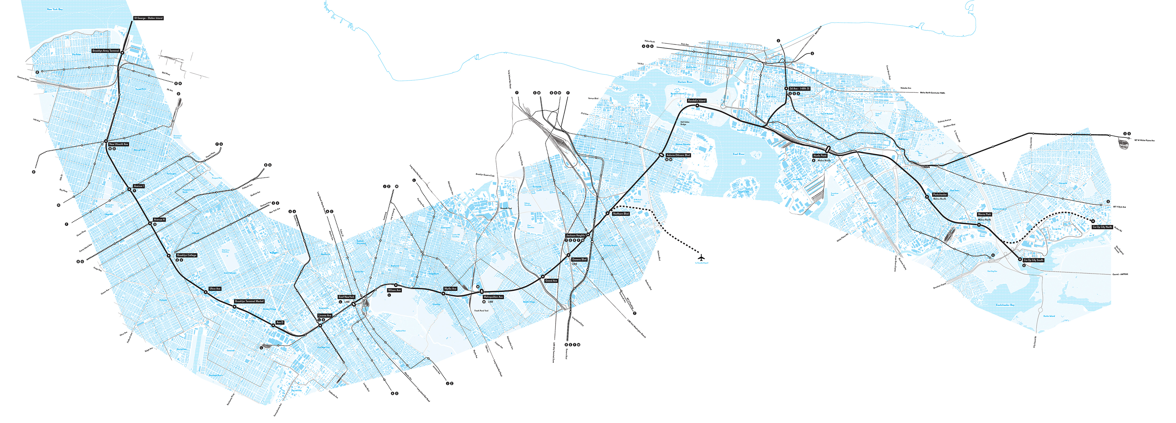
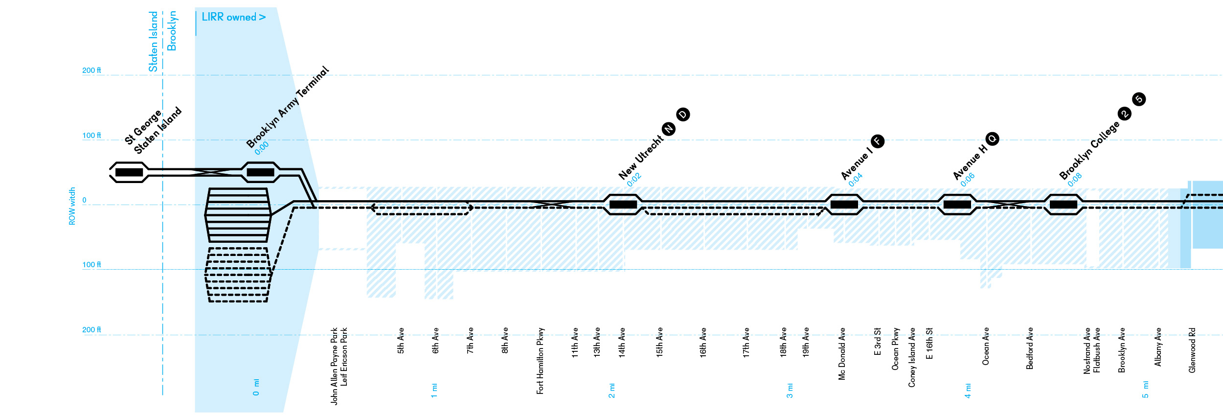
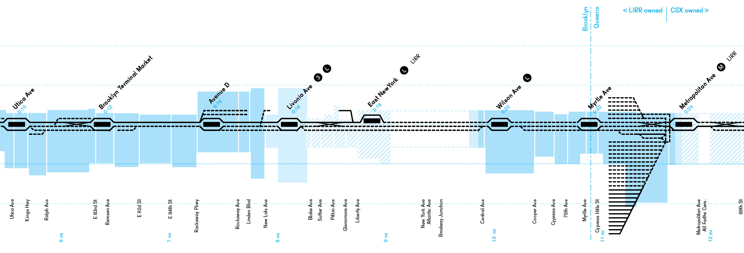
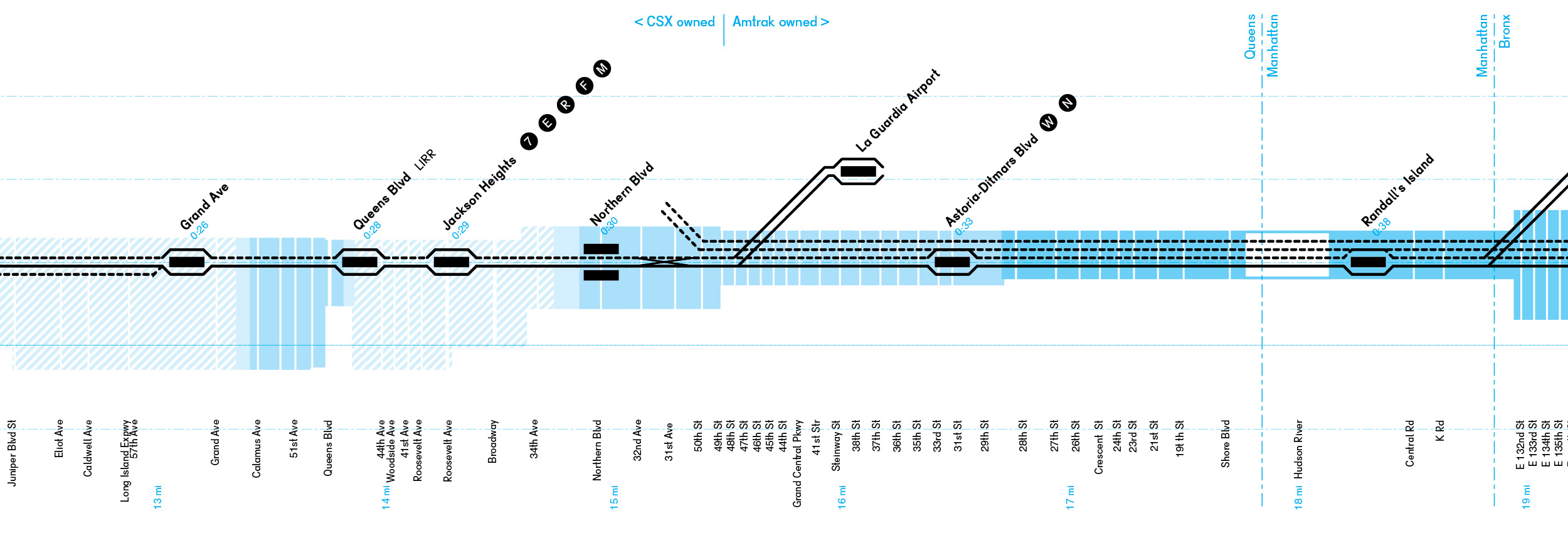
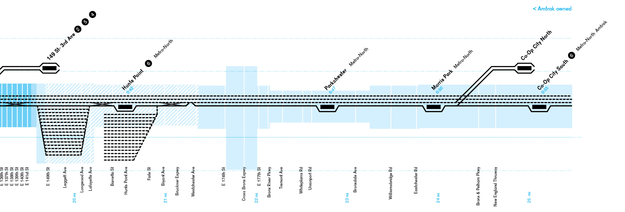
The Triboro Corridor, extending from Brooklyn to Queens to the Bronx, is over 24mi in length and covers 80 square miles in area, with a population of 2.6 million people. By 2040, the RPA anticipates that its population will increase by 400,000 people. This often-overlooked territory, the outer boroughs, will play in an important role in the future of the region, particularly given the increasing unaffordability of Manhattan and its surrounding environs. Rotating the map produces an unexpected and non- Manhattan-centric view of the corridor and brings into focus the outer boroughs.
The Triboro Corridor centers on the dual-purposing of an existing system of freight and intercity train lines. Through new passenger train service, Brooklyn, Queens and the Bronx can be connected. Where the region’s subway and train service now radiates from Manhattan, the Triboro will create a tangential connection and new spatial relationships between diverse communities, people, and jobs. This transformation produces redundancy and resiliency in the network, as first envisioned in the 1929 first regional plan.
The existing identity of the Triboro Corridor is highly fragmented. The corridor transects diverse communities and socioeconomic demographics. The question becomes: who will profit from the improved connectivity, the increased livability, and the new development opportunities? Can we avoid gentrification? Can we transform the area to become even more important as an emancipation and empowerment engine, while keeping its existing and diverse communities intact? Rather than unifying the identity of the corridor with the introduction of generic new developments, can we intensify its differences and uniqueness, building on its local value?
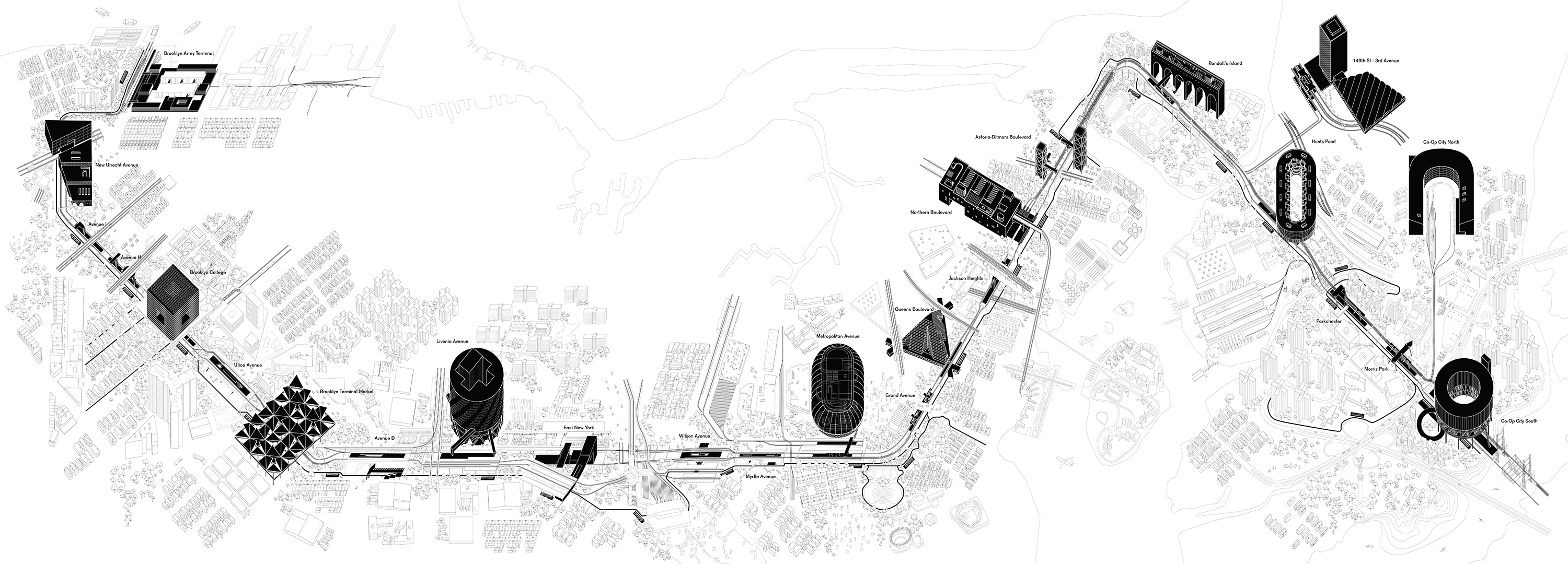
Our project consists of three layers: a public project (the greening of the corridor through streetscapes and public spaces), a public/private project, and community-led and driven processes for development and growth that will be achieved through certain policy and financing mechanisms.
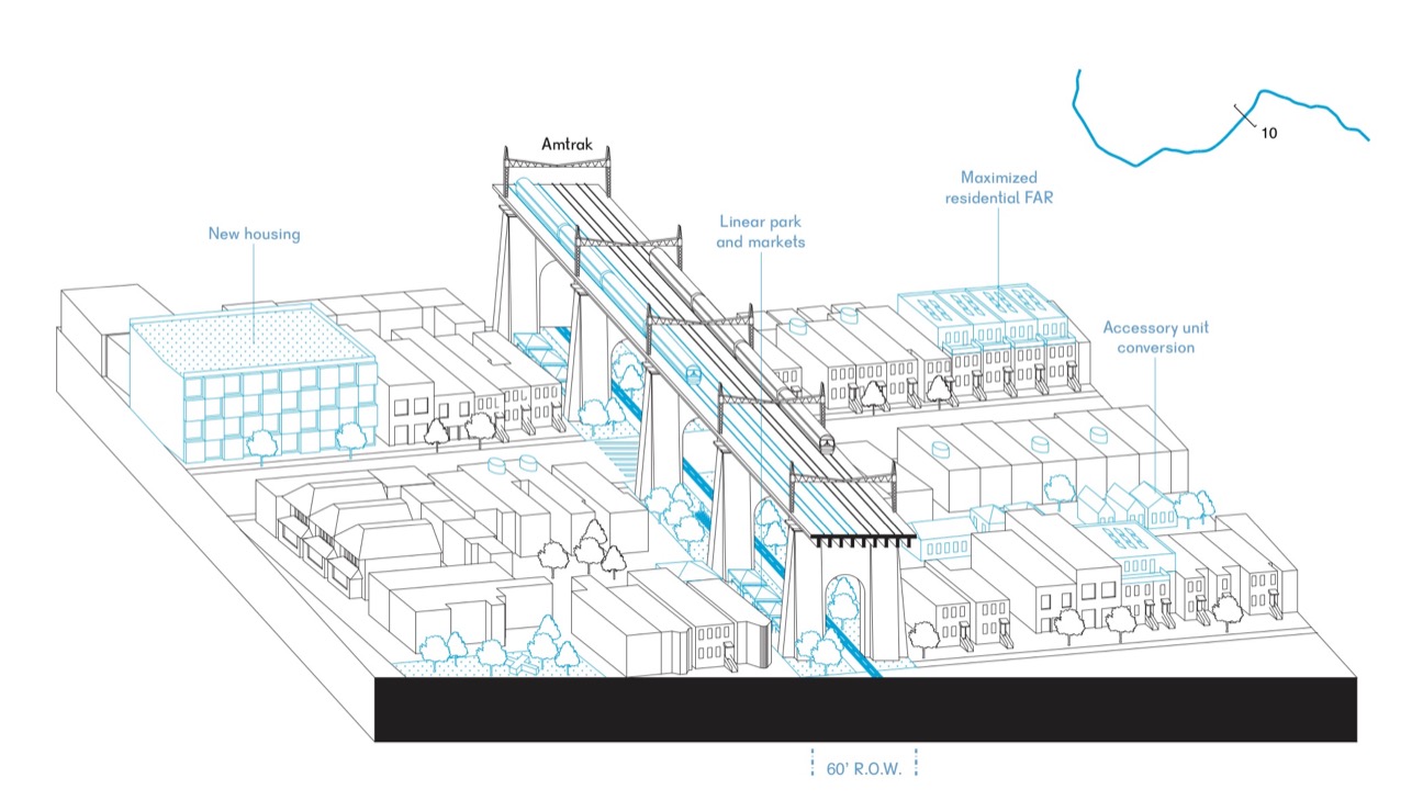
The above drawing represents the public/private project, which are 25 new stations to which provide intermodal connections between new passenger service to subway, trains, bicycles, and other forms of current and future mobility. While some stations are simple platforms, other, more complex infrastructure nodes will require significant investment to be resolved. At the same time, these locations can also greatly benefit from increased density through spot up-zoning. Catalytic projects, achieved through public-private partnership, may also speed up the transformation of certain economic sectors such as education, food, health care, and manufacturing.
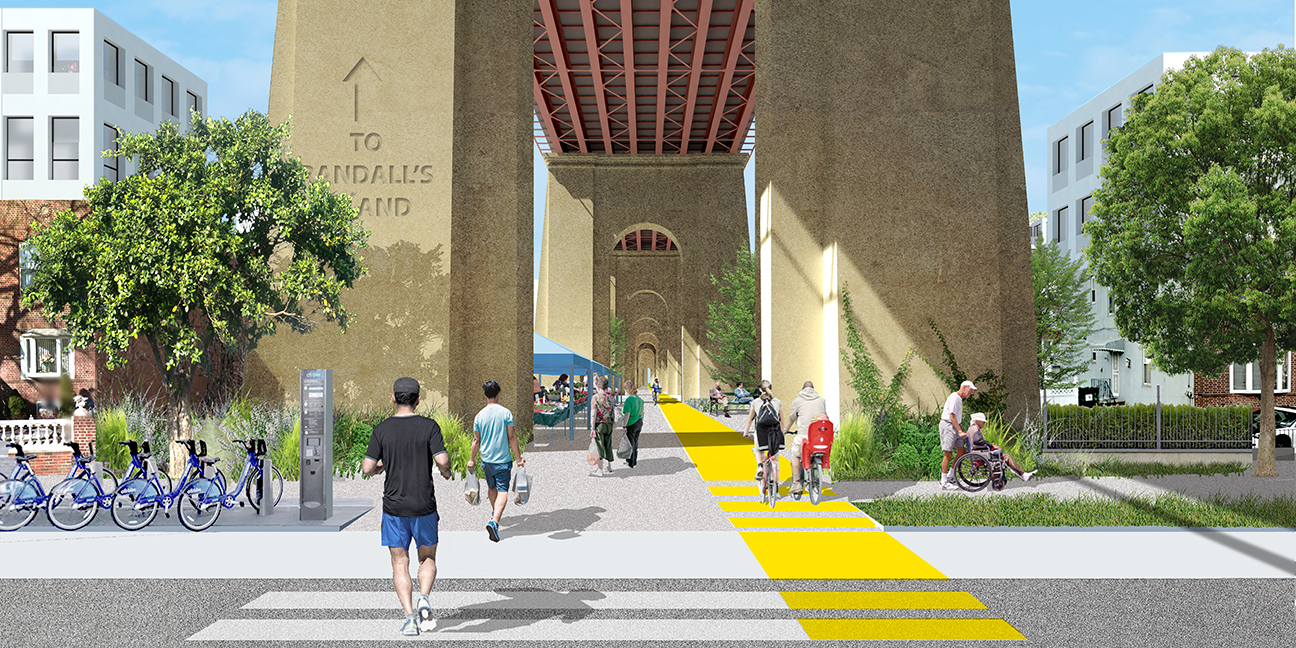
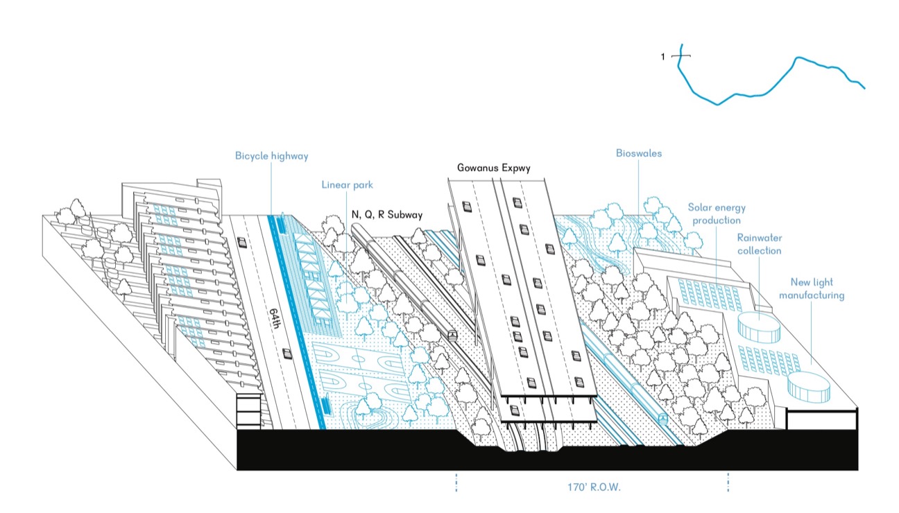
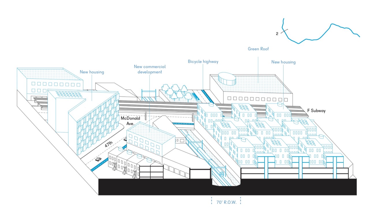
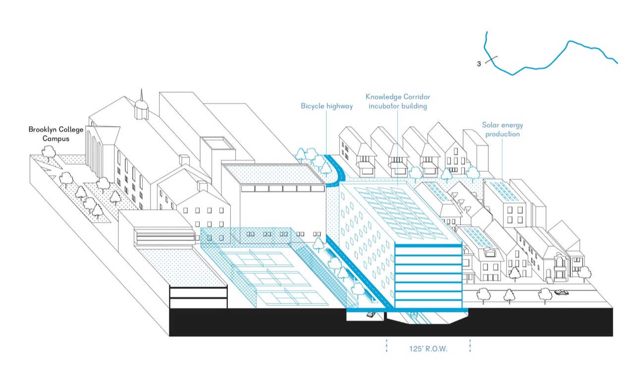
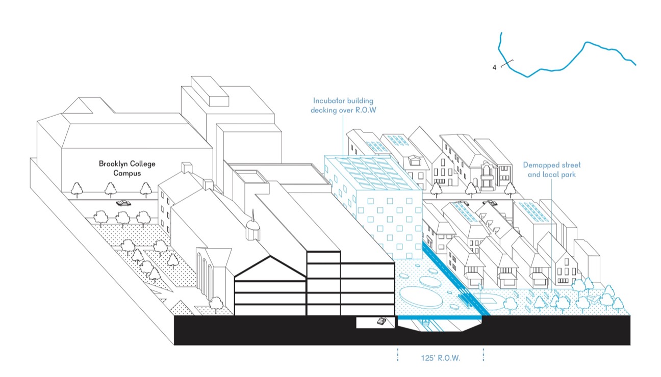
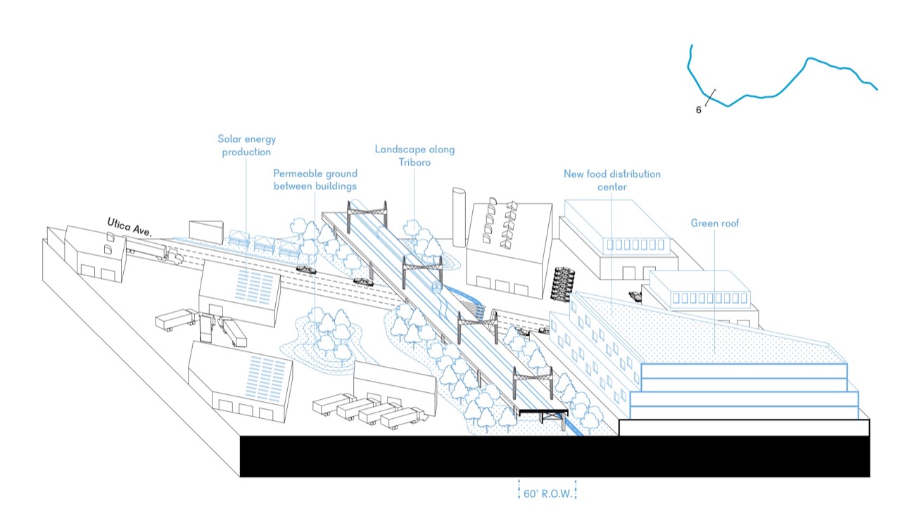
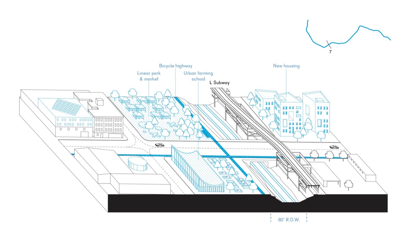
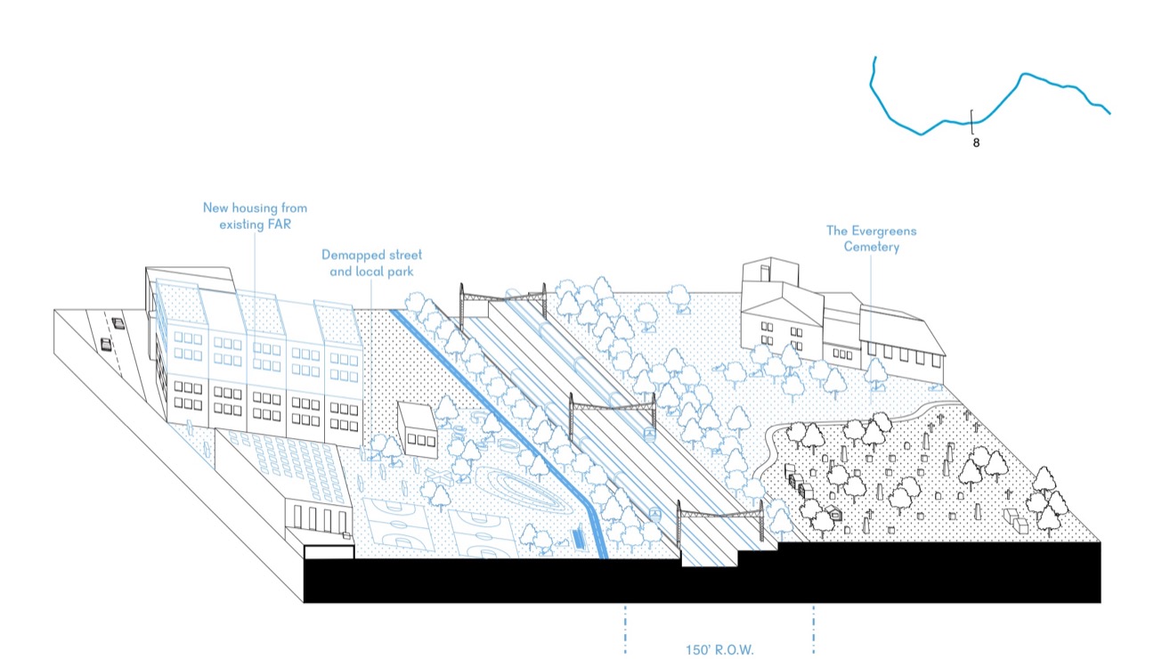
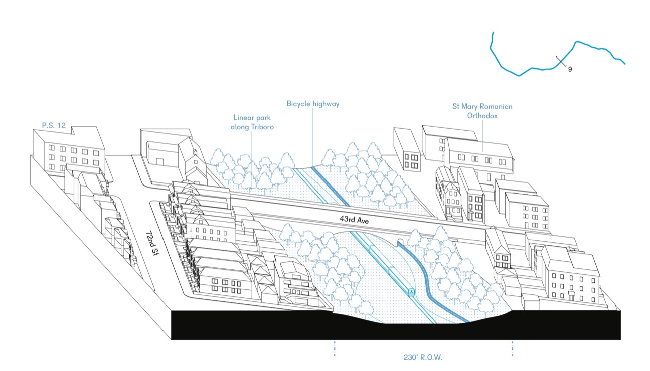
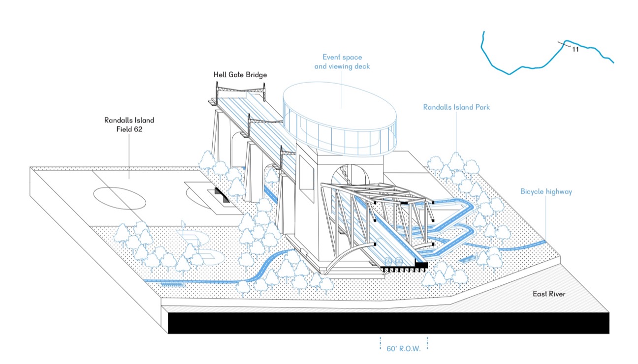
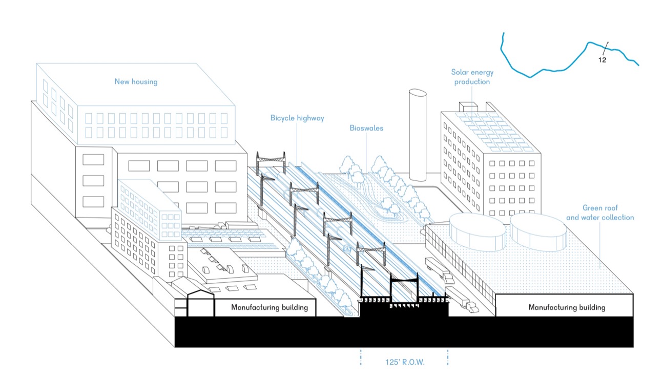
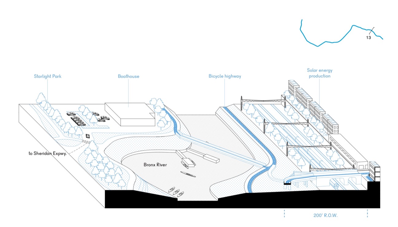
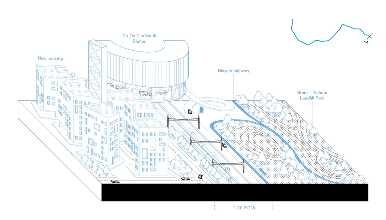
Our work focused on both the nodes, but also the between spaces. Using the existing right-of-way and adjacent spaces, the Triboro can become a 24 mile linear park and greenway, providing new public and collective space, improving health, managing water, and providing recreational opportunities and spaces to play. The corridor will also become a “bicycle superhighway” for commuters and recreational users, with bike sharing stations, bike facilities, dedicated lanes, and routes for longer trips. Simple bike/pedestrian connections will be introduced at now dead-end streets, and bridges or viaducts at vital connections will restore the street grid. In other areas, where parking may be reduced in the future, perpendicular streets will be de-mapped.
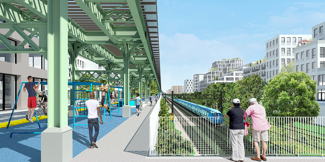
A series of sections demonstrate strategies that may be encountered along the Triboro. While they correspond to specific places, the intent is for the sections to be prototypical conditions, capable of providing architectural and landscape strategies that can be deployed along the extent of the corridor. In a way, the project is not a top-down masterplan, but rather a set of non-integrated strategies that can be implemented incrementally and locally.
Project Information
| Type | Regional Planning, Transit Infrastructure, Urbanism |
|---|---|
| Client | Regional Plan Association 4C Initiative, supported by the Rockefeller Foundation |
| Location | New York, NY |
| Scale | 80 square miles, 24 miles in length |
| Status | Completed, 2017 |
| Collaboration | One Architecture |
| Team | Kutay Biberoglu, Pierre de Brun, Karolina Czeczek, Adam Frampton, Angelina Andriani Putri, James Schrader |
Awards
2018 Architect’s Newspaper Best of Design Awards, Winner, Urban Design
2018 AIANY + ASLANY Transportation & Infrastructure Design Excellence, Merit Award
Selected Press and Publications
The Architect’s Newspaper 12/05/2018 (online) & 12/2018 (print, PDF)
The Architect’s Newspaper 01/31/2018 (online) & 01/03/2018 (print)
The Architect’s Newspaper 08/09/2017
6sqft 08/08/2017
Curbed 06/28/2017
The Architect’s Newspaper 06/28/2017
6sqft 06/28/2017
Route Fifty 03/05/2017
The Architect’s Newspaper 03/03/2017

